#Counter :30532
-
Being the most vulnerable and inhabited by the poorest of the poor , drylands ecosystems demands attentions to feed the malnutrished and underprivileged.
-
Mapping dryland cropping systems using space borne satellites provides historical and current status of Landuse and the change dynamics
More...
Geo Spatial data generated at
different scales about agro-climatic
and edaphic conditions in the form
of layers can be used to create homogeneous geocovers zones of a combination & these factors.
More...
Mobile APP for Ground data Collection database portal.
More...
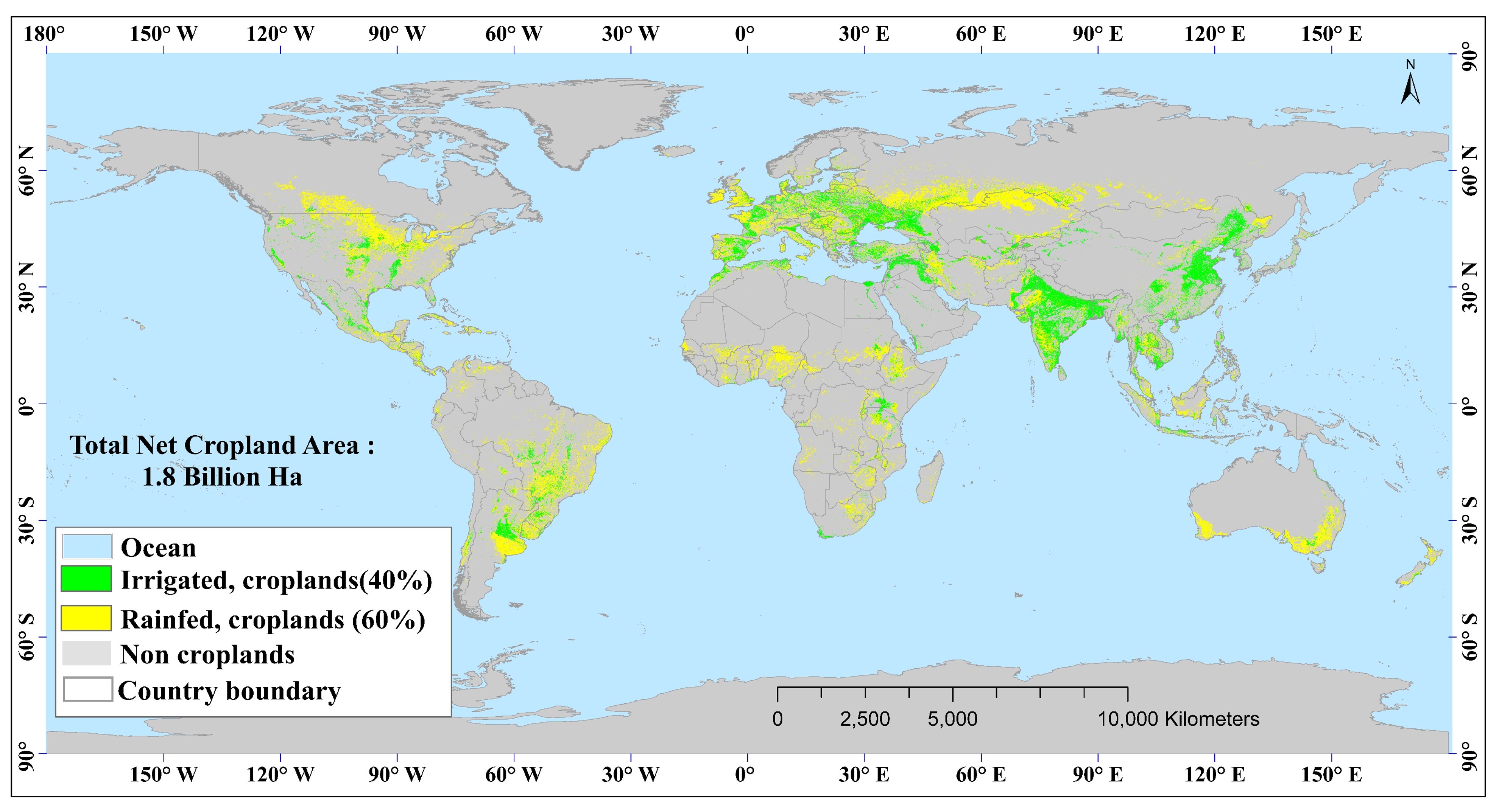
Landsat-derived Global Rainfed and Irrigated-Area Product @30m (LGRIP30)
...
More...
Temporal Rice Fallows Monitoring using MODIS 250 meter (2000-2020).
...
More...
The project aims at increasing the adoption of insurance solutions and risk management measures by India’s smallholder farmers for increased resilience to climate related risks through use of advanced remote sensing technology and science-led advisories through collective action.
As a part of the project, ICRISAT deals with the Remote sensing products, which plays an important role in insurance solutions and risk management. (Oct 2018 - Dec 2021)
...
Crop wise Area and Production
Year wise changes in cultivated area
...
Publications
Remote sensing & GIS Publicaitons and Journal articles More...
About Us
Contact Information More...


 1
1 2
2 3
3 4
4 5
5