Introduction
The MURO project (Millets in Upland Region of Odisha) promotes millet cultivation in upland rainfed ecosystems of Odisha to improve crop resilience, diversify cropping systems and enhance food and nutritional security of smallholder farmers.
Why is this project required
Current challenges
In Odisha, agriculture has long focused on rice cultivation, particularly in rainfed ecosystems. However, this dependence poses challenges like water scarcity and moisture stress, leading to lower yields and limited financial returns for farmers. Additionally, nutritional deficiencies, as highlighted by the National Family Health Survey (NFHS) 2015-16, further underscore the urgent need for intervention. Thirty four percent of children suffer from malnutrition, emphasizing the critical importance of addressing food and nutritional security issues.
Project solution
The MURO (Millets in Upland Region of Odisha) project offers a solution by promoting the cultivation of millets as an alternative to rice. Millets, known for their resilience to adverse weather conditions and high nutritional value, provide a dual-purpose option by serving both as food and feed crops. This project aims to diversify crops, enhance climate resilience, and improve food and nutritional security in Odisha, thereby addressing pressing agricultural and socio-economic challenges.

Where is this project targeted
MURO integrates ground data collection, crop classification, and field trials to support data-driven decision-making. These efforts combine scientific insights with local practices to strengthen food security and promote climate-resilient agriculture.
Through partnerships and innovation, the project empowers smallholder farmers to adopt millets for long-term sustainability in upland ecosystems.
Materials and Methods
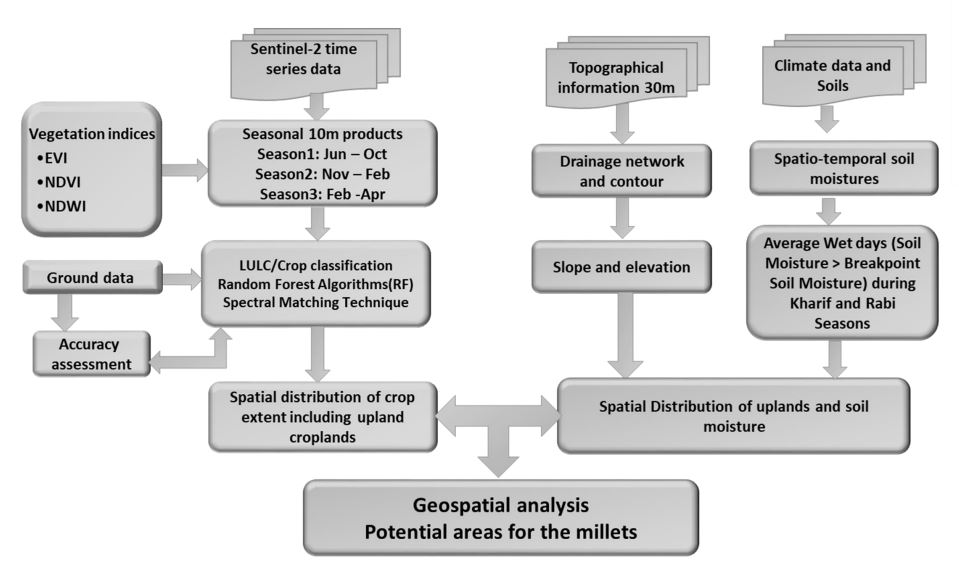
The project utilizes geospatial technology suitable for interventions. We combine remote sensing (classification of upland parcels using Sentinel-derived indices), ground truth collection and field trials to create actionable recommendations for farmers and stakeholders.
Portfolios
Ground data
Data collection has been done in upland study areas.
Classified maps
Data collected and classified maps have been prepared.
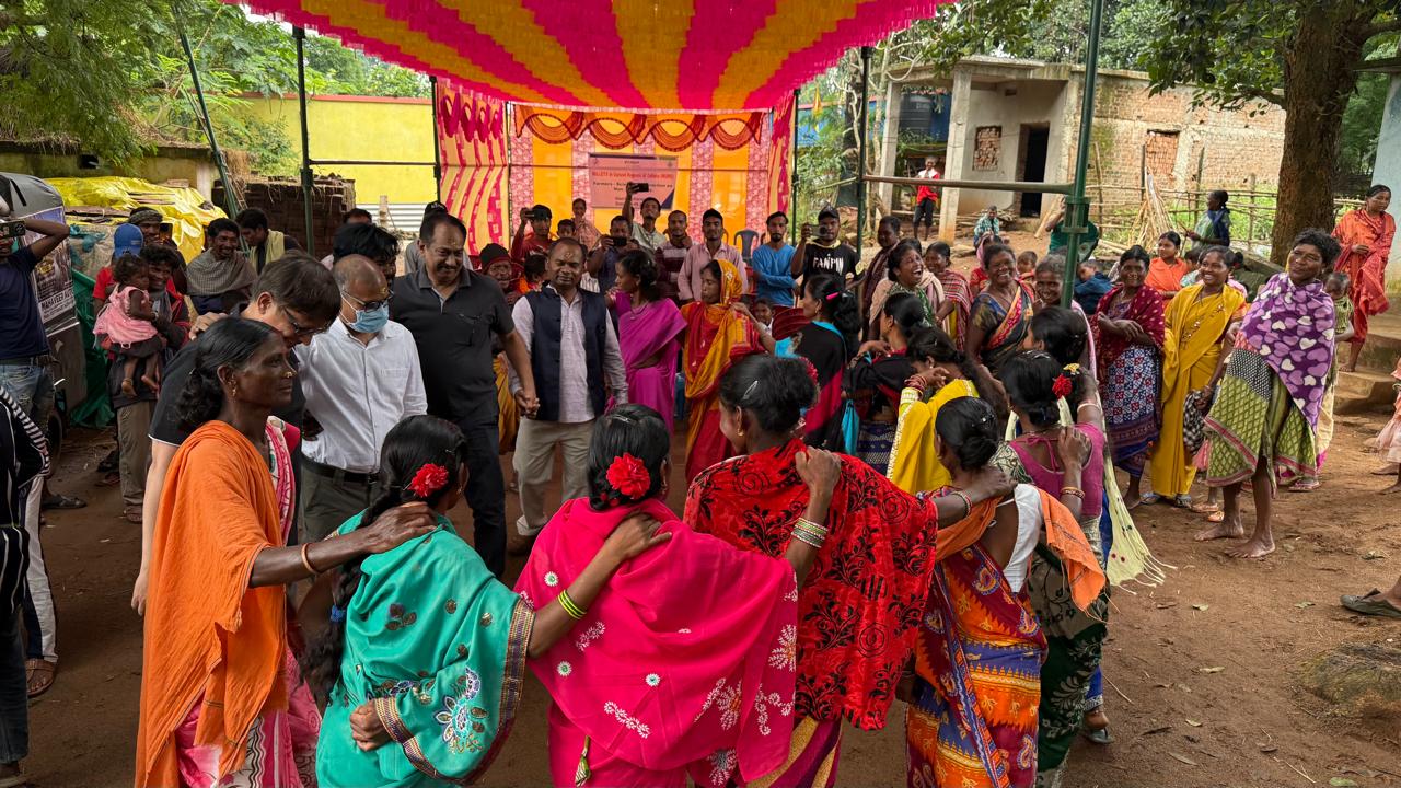
Field Visit
A gallery of field photos.
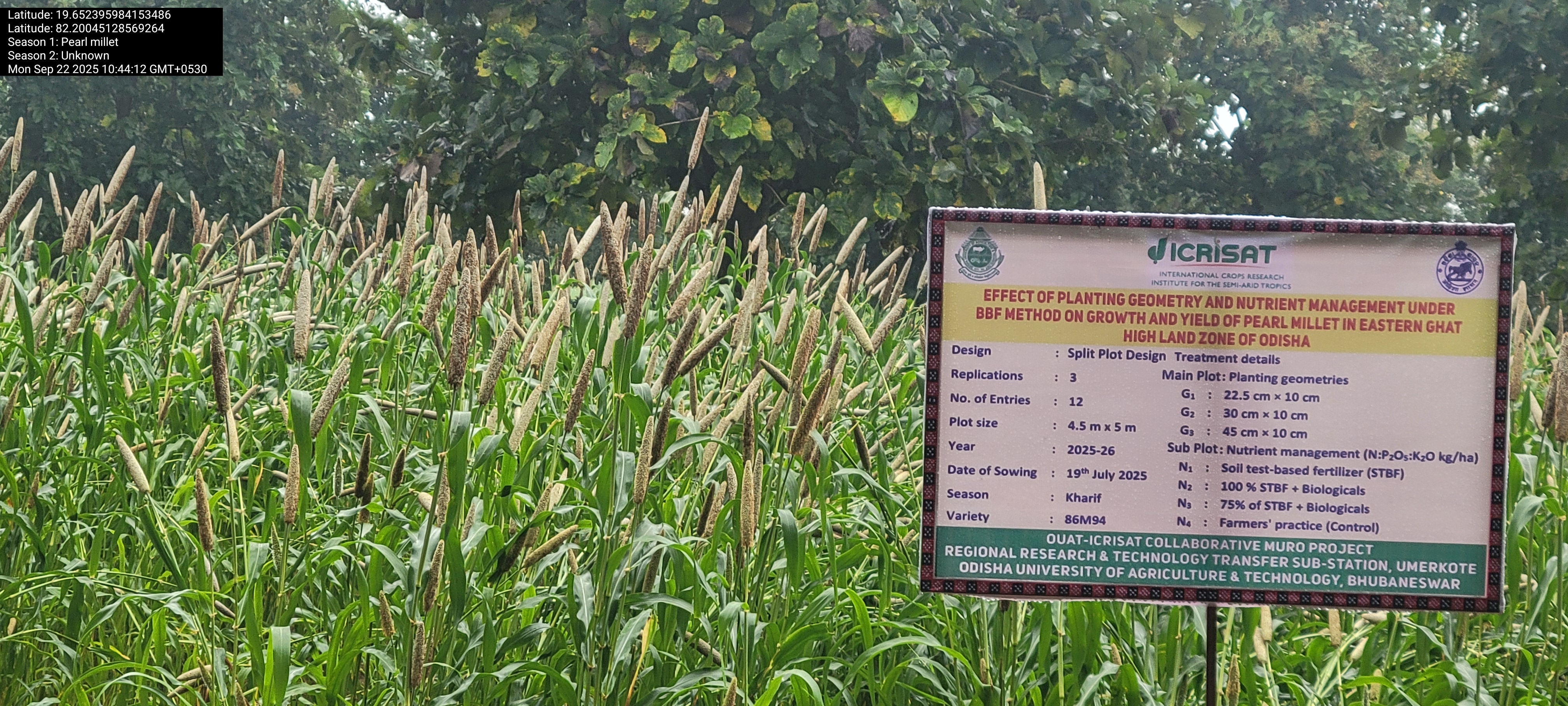
Field Trials
Images from field trials and varietal demonstrations.
Research collaborators
List of collaborators in the project:
- ICRISAT - Remote Sensing
- ICRISAT - Agronomy & Plant Breeding
- State Agriculture Department, Odisha
- Local NGOs & Farmer Groups
- University partners
- Technology partners