Agriculture and Food Security
Agriculture plays a pivotal role in ensuring global food security, as it provides the primary means of sustenance for the world's growing population. However, the sector faces significant challenges, including climate change, land degradation, water scarcity, and shifting socio-economic conditions. To meet the demands of an increasing population, agricultural systems must become more resilient, efficient, and sustainable. This requires not only the adoption of modern technologies, such as precision agriculture, advanced irrigation methods, and biotechnology, but also the implementation of sustainable farming practices that preserve natural resources. Furthermore, improving access to information, enhancing supply chains, and supporting smallholder farmers are critical for reducing hunger and achieving food security, particularly in vulnerable regions. A robust and adaptive agricultural system is essential for feeding the world, addressing malnutrition, and promoting economic stability.
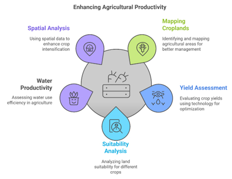
Focus Areas:
Within our cluster, we emphasize several focus areas to advance agricultural knowledge and enhance decision-making:
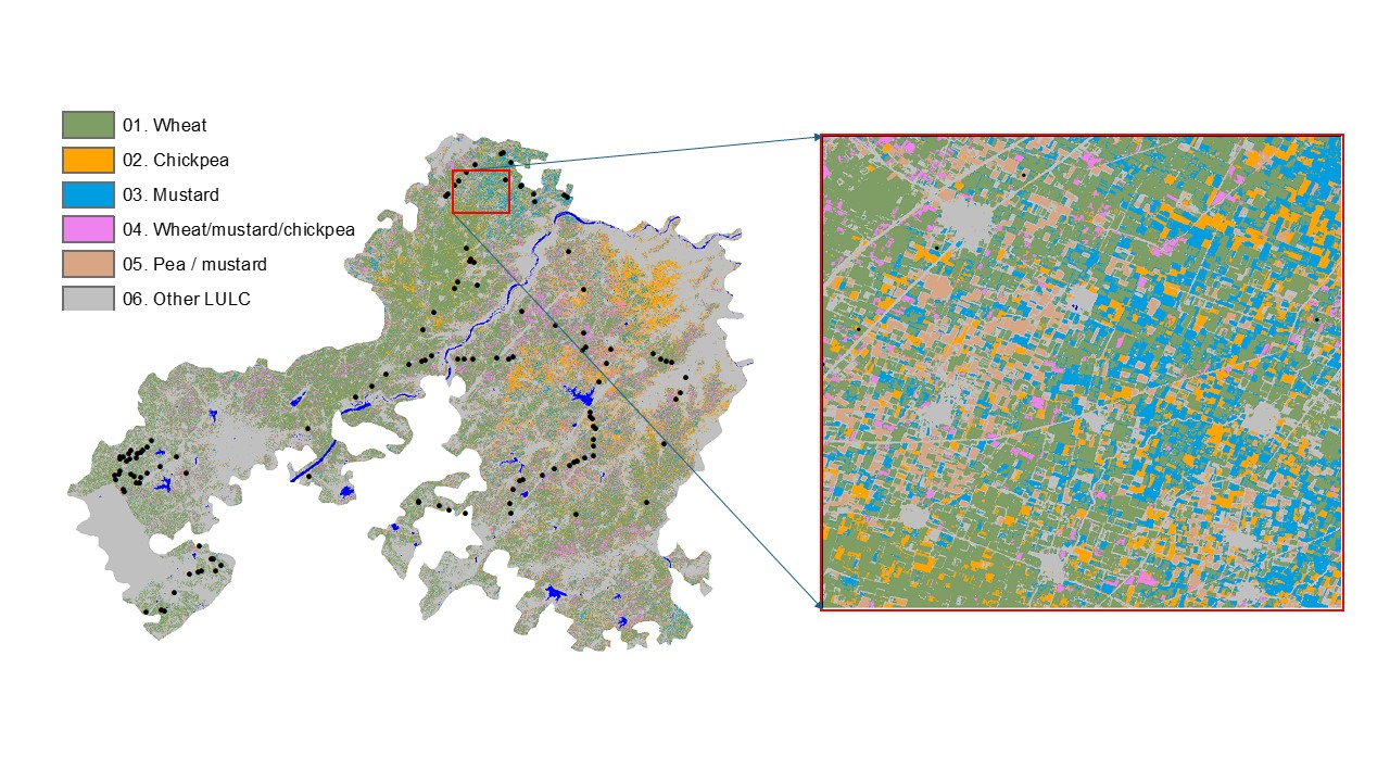
Cropland products of South Asia
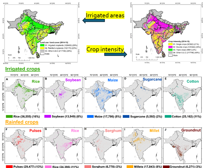
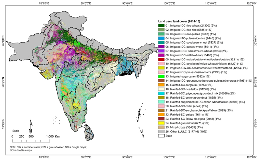
Cropland products are of great importance in water and food security assessments, especially in South Asia, which is home to nearly 2 billion people and 230 million hectares of net cropland area. In South Asia, croplands account for about 90% of all human water use. Cropland extent, cropping intensity, crop watering methods, and crop types are important factors that have a bearing on the quantity, quality, and location of production. Currently, cropland products are produced using mainly coarse-resolution (250–1000 m) remote sensing data. As multiple cropland products are needed to address food and water security challenges, our study was aimed at producing three distinct products that would be useful overall in South Asia. The first of these, Product 1, was meant to assess irrigated versus rainfed croplands in South Asia using Landsat 30 m data on the Google Earth Engine (GEE) platform. The second, Product 2, was tailored for major crop types using Moderate Resolution Imaging Spectroradiometer (MODIS) 250 m data. The third, Product 3, was designed for cropping intensity (single, double, and triple cropping) using MODIS 250 m data. For the kharif season (the main cropping season in South Asia, Jun–Oct), 10 major crops (5 irrigated crops: rice, soybean, maize, sugarcane, cotton; and 5 rainfed crops: pulses, rice, sorghum, millet, groundnut) were mapped. For the rabi season (post-rainy season, Nov–Feb), five major crops (three irrigated crops: rice, wheat, maize; and two rainfed crops: chickpea, pulses) were mapped. The irrigated versus rainfed 30 m product showed an overall accuracy of 79.8% with the irrigated cropland class providing a producer’s accuracy of 79% and the rainfed cropland class 74%. The overall accuracy demonstrated by the cropping intensity product was 85.3% with the producer’s accuracies of 88%, 85%, and 67% for single, double, and triple cropping, respectively. Crop types were mapped to accuracy levels ranging from 72% to 97%. A comparison of the crop-type area statistics with national statistics explained 63–98% variability. The study produced multiple-cropland products that are crucial for food and water security assessments, modeling, mapping, and monitoring using multiple-satellite sensor big-data, and Random Forest (RF) machine learning algorithms by coding, processing, and computing on the GEE cloud.read more ...