Tools and Technologies
Remote sensing and GIS are indispensable tools for understanding and managing the Earth’s resources. By capturing, analyzing, and visualizing data in spatial formats, these technologies provide valuable insights for scientific research, policy-making, and operational planning. As both technologies continue to advance, their applications will play an even greater role in addressing global challenges such as climate change, urbanization, food security, and disaster resilience. The Geospatial and Big Data Sciences Cluster is dedicated to providing critical spatial inputs that enhance understanding, planning, and prioritizing agricultural research. Our cluster integrates multiple disciplines of agriculture and leverages geospatial information and big data analytics to address various agricultural challenges.
The Cluster plays a vital role in supporting research programs by generating geospatial information using Remote Sensing (RS), Global Positioning System (GPS), and Geographic Information System (GIS) technologies. Our focus extends from crop distribution and yield estimation to identifying stresses and addressing issues related to water use, productivity enhancement, soil health management, agrobiodiversity conservation, and climate variability. We utilize big data analytics to extract valuable insights from our extensive long-term datasets, which are generated from experiments and trials.
Focus Areas:
Within our cluster, we emphasize several focus areas to advance agricultural knowledge and enhance decision-making:
- High-Resolution Satellites
- > WorldView-3 and WorldView-4: High-resolution satellites by Maxar, capable of capturing images with up to 30 cm resolution, useful for precise land-use and environmental monitoring.
- > PlanetScope and RapidEye: Planet Labs' constellations provide daily global imagery with high spatial resolution, ideal for agricultural monitoring and forest management.
- Hyperspectral Imaging
- > PRISMA (Italian Space Agency): Offers hyperspectral imaging capabilities, allowing for the detailed analysis of materials based on their spectral signatures, useful for mineral exploration, agriculture, and environmental monitoring.
- > DESIS (DLR Earth Sensing Imaging Spectrometer): Mounted on the International Space Station, DESIS captures hyperspectral data for applications such as water quality assessment and vegetation analysis.
- Synthetic Aperture Radar (SAR)
- >Sentinel-1 (ESA): Part of the Copernicus program, Sentinel-1 provides C-band SAR data that penetrates clouds, making it ideal for monitoring deforestation, soil moisture, and flood events.
- >RADARSAT Constellation: A Canadian mission that provides SAR imagery, offering insights into sea ice mapping, disaster response, and agricultural applications.
- Drones and UAVs (Unmanned Aerial Vehicles)
- > DJI Phantom and Matrice Series: Equipped with multispectral and thermal sensors, these drones are widely used for precision agriculture, forestry, and infrastructure monitoring.
- > SenseFly eBee X: A fixed-wing drone with various payload options, suitable for mapping large areas with high-resolution imagery for agriculture, mining, and construction.
- LiDAR (Light Detection and Ranging)
- > Velodyne and RIEGL LiDAR Systems: Widely used in aerial and ground-based applications for creating detailed 3D models of landscapes, forests, and urban areas.
- >NASA GEDI (Global Ecosystem Dynamics Investigation): Mounted on the ISS, GEDI provides high-resolution LiDAR data to study forest structure and biomass, contributing to carbon stock analysis.
- AI and Machine Learning for Remote Sensing
- > Google Earth Engine: A cloud-based platform that combines petabytes of satellite imagery with machine learning tools, allowing for large-scale environmental monitoring and analysis.
- > Microsoft AI for Earth: Offers tools and resources for analyzing satellite data to address issues in agriculture, biodiversity, climate, and water resources.
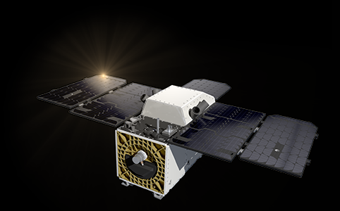
- CubeSats and Nano-Satellites
- > Planet Dove Satellites: Planet operates one of the largest fleets of CubeSats, providing daily global imagery at a resolution of 3-5 meters, useful for applications requiring frequent updates.
- > ICEYE SAR CubeSats: ICEYE's small SAR satellites provide high-frequency, all-weather imaging, valuable for monitoring infrastructure, oil spills, and maritime activity.
- Thermal Infrared Remote Sensing
- > ECOSTRESS (Ecosystem Spaceborne Thermal Radiometer Experiment on Space Station): Measures plant water stress and heat, which helps with drought assessment and water resource management.
- > Landsat 8 and 9 TIRS (Thermal Infrared Sensor): Provides thermal data that supports urban heat island monitoring, water body temperature analysis, and agricultural drought monitoring.
- Remote Sensing Data Processing Software
- > ENVI and ERDAS IMAGINE: Widely used remote sensing software with advanced tools for analyzing hyperspectral, multispectral, and LiDAR data.
- > QGIS with Remote Sensing Plugins: An open-source GIS platform that supports various remote sensing data types with plugins for processing and visualization, often combined with machine learning tools.
- Ground-based Remote Sensing Tools
- > Portable Spectroradiometers: Instruments like the ASD FieldSpec allow for ground-truthing of satellite data by measuring the spectral properties of materials on-site.
- > Eddy Covariance Towers: Measure fluxes of CO₂, water vapor, and energy between ecosystems and the atmosphere, contributing to climate and carbon cycle studies.