Geospatial analysis to identify millet suitable areas in the upland rice ecosystem of Odisha
Assessing public health risks from crop residue burning, a spatiotemporal case study in Telangana, India
Soil Organic Carbon Mapping Using Multi-Frequency SAR Data and Machine Learning Algorithms
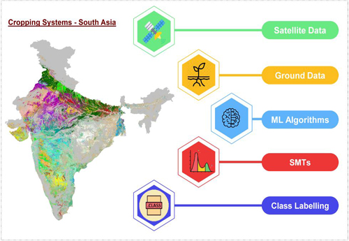
Spatial Distribution of Cropping Systems in South Asia Using Time-Series Satellite Data Enriched with Ground Data
A framework for disaggregating remote-sensing cropland into rainfed and irrigated classes at continental scale
Optimizing Crop Yield Estimation through Geospatial Technology: A Comparative Analysis of a Semi-Physical Model, Crop Simulation, and Machine Learning Algorithms
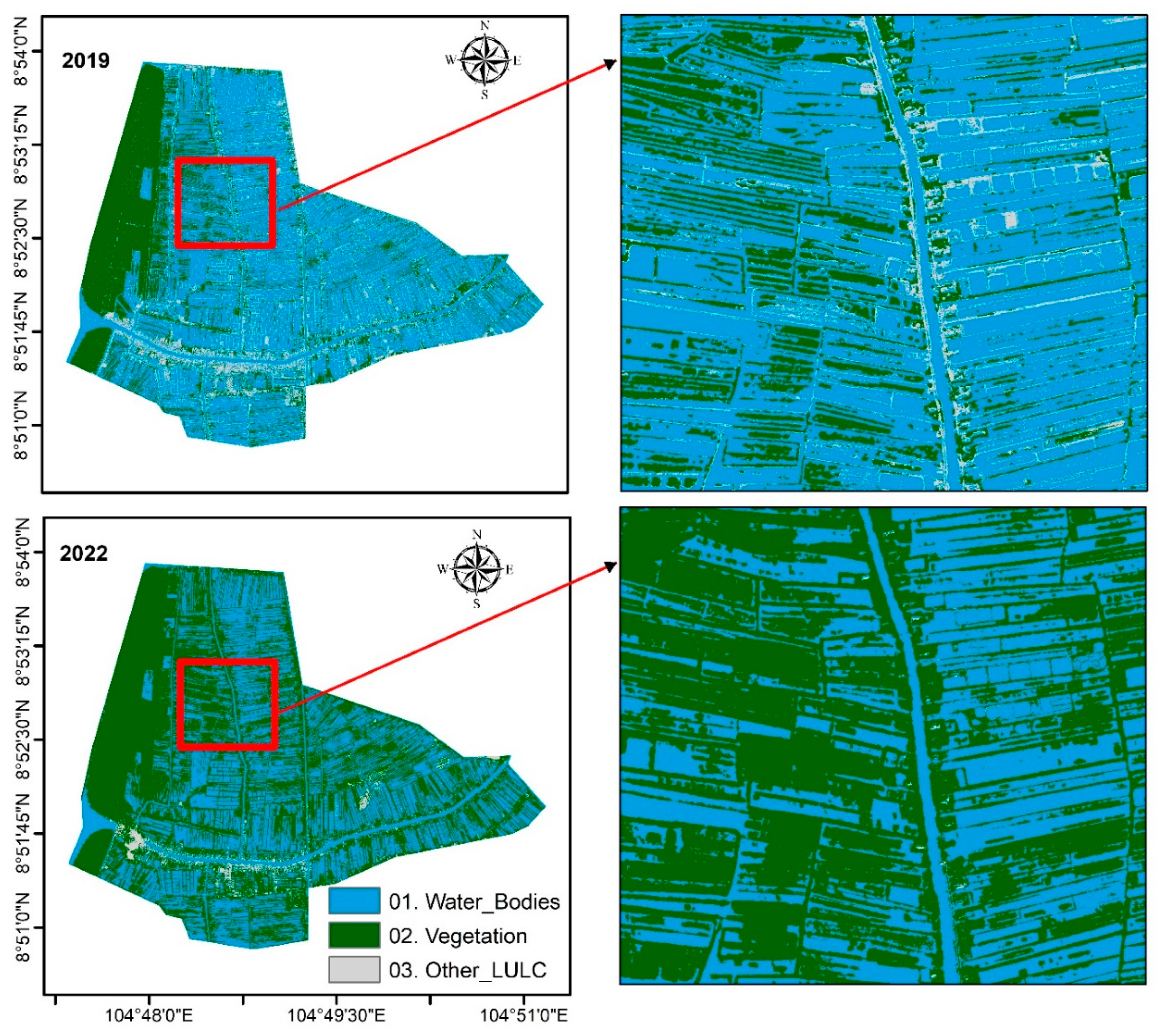
Impacts of irrigation tank restoration on water bodies and croplands in Telangana State of India using Landsat time series data and machine learning algorithms
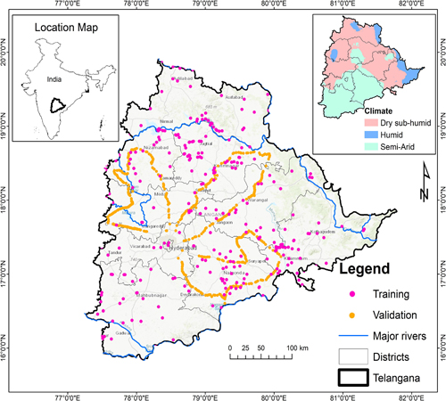
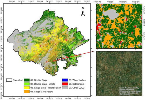
Identifying prospects and potential areas for introducing pearl millet stress-tolerant cultivars in Rajasthan, India: A geospatial analysis
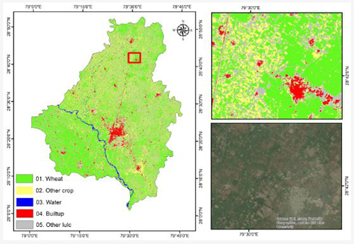
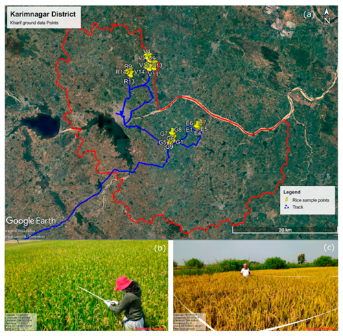
Crop Yield Assessment Using Field-Based Data and Crop Models at the Village Level: A Case Study on a Homogeneous Rice Area in Telangana, India
Mapping Shrimp Pond Dynamics: A Spatiotemporal Study Using Remote Sensing Data and Machine Learning
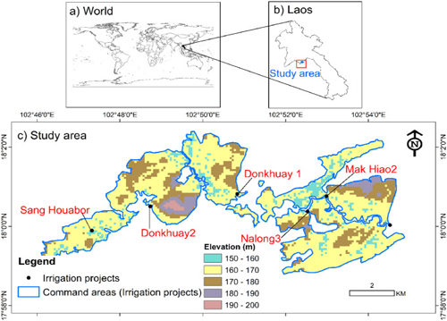
Assessment of Cropland Changes Due to New Canals in Vientiane Prefecture of Laos using Earth Observation Data
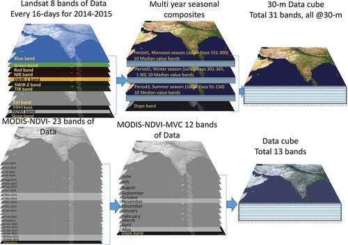
Multiple agricultural cropland products of South Asia developed using Landsat-8 30 m and MODIS 250 m data using machine learning on the Google Earth Engine (GEE) cloud and spectral matching techniques (SMTs) in support of food and water security